
Lib64: Automobile road map of St. Louis County
Item
Charles Hoelscher Maps. 1920. Lib64: Automobile Road Map of St. Louis County, Higher Ground: Honoring Washington Park Cemetery, Its People and Place, accessed June 4, 2026, https://digitalexhibits.library.wustl.edu/s/washington-park/item/39712
- Title
- Lib64: Automobile road map of St. Louis County
- Description
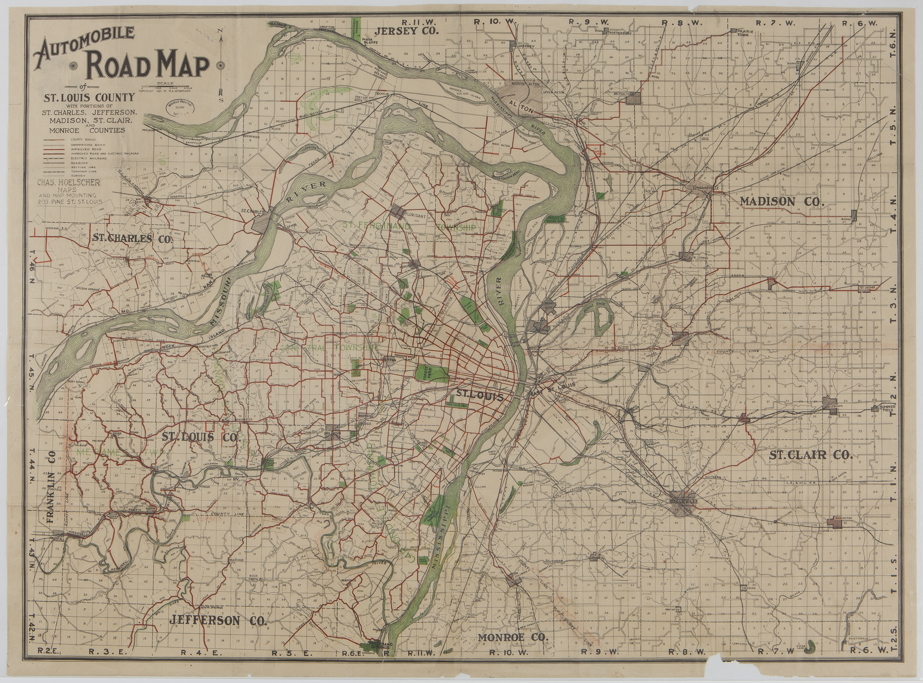
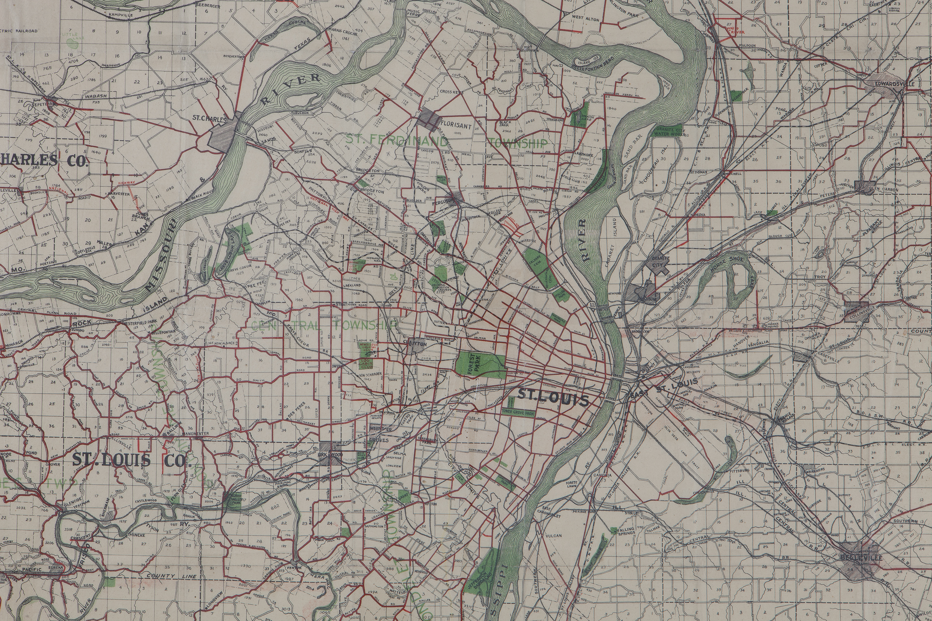
- Map showing major roads in the St. Louis metropolitan area before the appearance of Washington Park and other cemeteries along Natural Bridge. Courtesy of Missouri History Museum.
- Creator
- Charles Hoelscher Maps
- Date
- 1921
- Rights
- http://rightsstatements.org/vocab/CNE/1.0/
- Source
- Missouri History Museum
Charles Hoelscher Maps. 1920. Lib64: Automobile Road Map of St. Louis County, Higher Ground: Honoring Washington Park Cemetery, Its People and Place, accessed June 4, 2026, https://digitalexhibits.library.wustl.edu/s/washington-park/item/39712